The 3D digitization of the Nicosia International Airport
The World Heritage Convention, drawn up by various international bodies in 1972, was designed to protect cultural or natural places of outstanding universal value so that future generations may be able to enjoy them. According to those principles the NIC Project, named after the old IATA code for the International Airport of Nicosia, represents an industrial archaeology multidisciplinary project led by the STARC of the Cyprus Institute (www.cyi.ac.cy) , which aims to preserve and promote digitally one of the main iconic sites of the recent history of Cyprus.
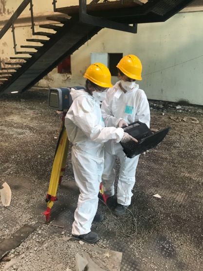
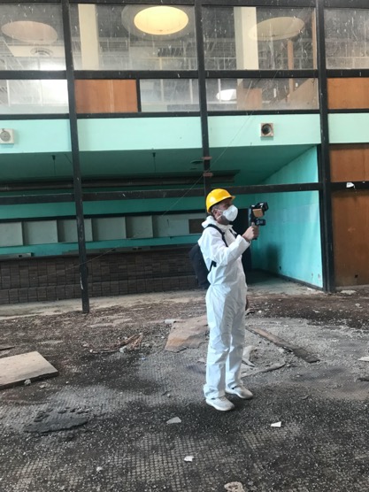
During the initial phase of the project a terrestrial laser scanning campaign, coupled with a mobile mapping system, was concluded by the APAC Labs of the Cyprus Institute to digitize the internal and external structures of the main terminal. Due to the environmental conditions special protective gears were used to comply with health and safety regulations concerning the identified on-site hazards.
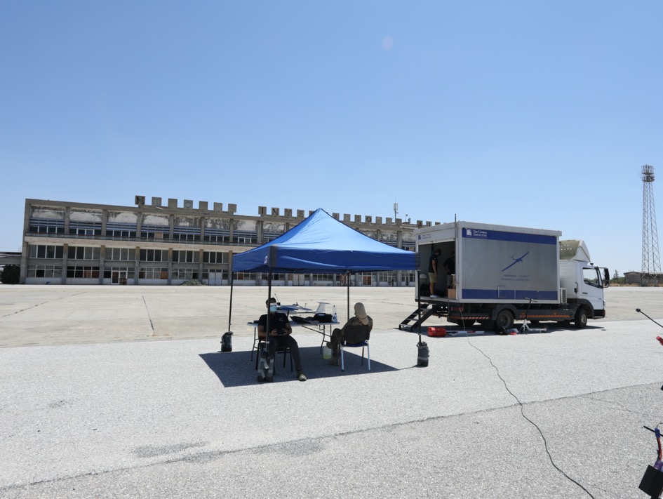
For the digitization of the tarmac, and the two intersecting runways and the building rooftops a special photogrammetric drone survey, which allows to create 3D models out of 2D images, was realized by the Unmanned Systems Research Laboratory (USRL) team of the Cyprus Institute under the direct supervision of the UNIFICYP personnel. The aerial survey was performed using the novel fixed wing Unmanned Aerial System (UAS) developed by USRL optimized for aerial image acquisition of large areas.
Project targets
Due to the airport’s symbolic importance for both Cypriot communities, the difficulties to visit the site (today it is located inside what is known as green line or buffer zone), and the risk to quickly lose it because the lack of regular maintenance, the NIC project intend to use a wide range of digital technologies and interactive techniques to:
- Visualize the airport buildings, its surrounding, and the abandoned planes in form of panoramic images and 3D models recorded with state-of-the-art digital technologies;
- Access historical and scientific metadata, interview of individuals who have memories of the airport, historical footage related to each virtual object which will serve as a digital platform for storytelling;
- Experience va virtual visit of the site through immersive VR headset;
- Create multimedia products for education and dissemination purposes.
Multi-Level and Multi-Sensor Approach
The NIC Project focuses on an interdisciplinary 3D modelling and visualization process, consisting of a top-down multi-scale image-and range-based digital documentation method developed to fulfil all the surveying needs and exploit all the intrinsic potentialities of the state-of-the-art 3D modelling techniques. The Cyprus Institute STARC team has a lot of experience in this type of technology, having for example deployed similar approaches for the 3D modelling of Othello’s tower in Famagusta, in cooperation with UNDP.
Landscape modelling
The first layer of documentation is represented by the Digital Elevation Model (DEM) of the airport area including the building terminal, apron, runway and surrounding areas. Due to the site extension and the necessity to acquire data on rooftop elements of buildings, digital aerial photogrammetry has been used for the initial digitization process.
The aerial imaging dataset was acquired exploiting Unmanned Aerial Vehicles (UAV) belonging to the USRL team of Cyprus Institute. To ensure high geometric accuracy, a Differential Global Positioning System (DGPS) was used. The survey campaign provided data in form of 3D models coupled with color values.
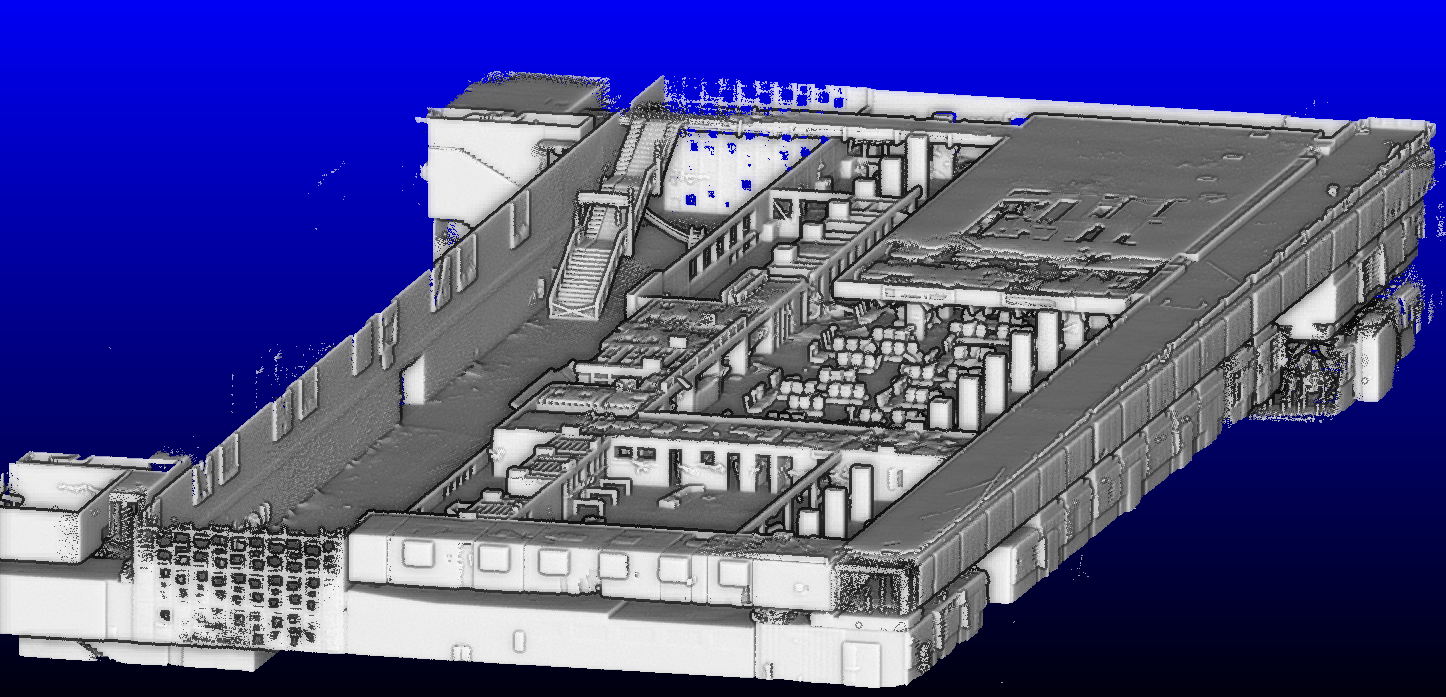
Structures and Buildings Modeling
For the digitization of the abandoned terminal and airport facilities, Terrestrial Laser Scanning and Mobile Scanning techniques were used.
Thanks to their fast acquisition rate, a large amount of geometric data, describing all the architectonic features and furniture left abandoned during last forty-four year, were collected. The wide array of collected digital data will be used to create an immersive environment exploiting Virtual Reality HMD (head-mounted display).
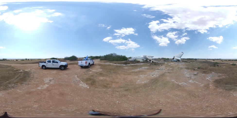
Panoramic Virtual Tour
Due to restrictions and hazards currently in place, a panoramic virtual tour was completed inside and outside the airport premises. The viewers will be able to interact with their surroundings and get a 360-degree view of the environment, without being physically there. It will be possible to access all the digitized areas comprising of the Main Terminal, the Control Tower, The Hangar, the Trident Plane, The Shackleton Plane and the Tupolev plane. This output will ease in the long-term the number of requests regularly received by UNFICYP to access the site by media and researchers.